Other than just a few highs clouds for early tomorrow morning, it should be a mostly sunny day with high temps just as warm as todays(near 70), if not a little warmer with 00zWRF showing upper 60`s to lower 70`s. Though, looks like we`ll have increasing clouds for late in the day tomorrow as a weak frontal system(seen on inferred satellite imagery tonight) comes ashore during the over night hours and into Sat with rain and showers over the lowlands by early Sat morning. Highs for Sat look to be in the mid 50`s to around 60. So will be just a little cooler with westerly flow taking over our region for the weekend. As mentioned, westerly flow will settle over our region for Sun and through much of next week with what looks to be an unsettled and active weather pattern.
This unsettled weather pattern that will effect our region for next week looks to be due to an area of low pressure that will and or is forecasted spin around over the open NE Pacific for much of the coming work week. This area of low pressure also looks to spin out little, but vigorous frontal systems toward our area that will leave us pretty wet at times. And even a few GFS models from today including tonights 00zGFS/WRF shows a possible breezy/ windy system that might give parts of Western WA some blustery conditions around mid-week. But think it may be something that might need to be watched if models continue to advertise this breezy system for mid-week. But however, the main 110+Kt 300mb jet stream looks be pointed at Oregon and perhaps Northern California through much of next week. So that area of the region looks to have the bulk of the active weather systems energy, though we still have our own unsettled weather with rain and showers at times with cooler conditions for the work week and maybe into the weekend as well. So over all, plan on a wet and cool week ahead.
Thursday, April 30, 2009
Monday, April 27, 2009
Possibly nice weather this upcoming weekend
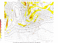 Good evening to all.
After looking at some of the models this evening and from this morning, it appears that the models over past several days look to be in general agreement about some split-flow with narrow ridge aloft and at the surface. Models kinda differ about how this will turn out, but it seems to be that the upper level jet will be aimed at Oregon or California in which we may possibly maintain at least partly cloudy skies for late in the week and into the weekend. On the 18zGFS, you see that the narrow ridge extends all the way up into Canada. The end result will be weakening/ splitting systems as they enter the...oh lets call this the 'high magnitude ridge', with parts of the frontal system heading well south of us. For past couple/few days now, the models have been showing a weak system heading into Oregon or California by Sat or Sunday......hence the split flow. But it looks as if this ridge might last into maybe Sun, though a frontal system looks to be sliding in during this time. So we`ll see. But so far, it does appear that we`ll see milder temps, but still comfortable over the weekend.
Feel free to comment, ect. :o)
Friday, April 24, 2009
The weekend is here....

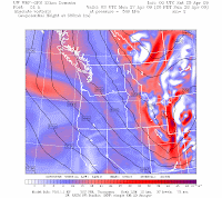 The weekend is here, and that means what ever plans you have outdoors, you may want to have a rain jacket handy as there will be some showers at times as a weak disturbance drops through here during the day tomorrow producing a few showers and possibly a CZ over the Northern interior. This system dropping through from the north is currently shown on inferred satellite imagery tonight. Should also feel like a coolish day as clouds and showers will be around as the WRF is showing low-mid 50`s for highs. Might see a bit of clearing late in the day, though will still have lots of clouds around.
Sun should be a better day and also drier/ and warmer with highs getting back to upper 50`s to lower 60`s for highs along with partly cloudy skies under N-NWLY flow aloft. However, it appears another weak system(shown on the 500mb chart and light shade of red over Vancouver Island) looks to drop down near us/ on us for a few showers and or chance showers mainly over the Olympics and perhaps the Cascades as well with lowlands seeing dry weather. So Sun is looking like the nicer of the two days for right now and also for what is see.
Thursday, April 23, 2009
Dry, seasonable conditions for the weekend
Good evening to all.


After looking at a few models here, it appears that our weekend will for the most part be a partly to mostly sunny one with seasonable highs in the mid 50 to upper 50`s to low 60`s. And our dry weather will be due to strong NWLY flow aloft, turning more Northerly late in the weekend. Though a weak piece of upper level energy may possibly drop down over us early Sat morning for a chance of showers on the back side of an upper level trough that will and or eventually get negatively tilted in our direction for around middle part of next week. And for the WRF12z is worth, it shows a PSCZ for early Sat over the North interior with just a FEW ISOLATED showers eles where. So over all, should be pretty good weekend to be outdoors.
The first two images are for 8am Sat with first image showing the 3hr precip/ CZ and the 500mb chart showing the NWLY flow aloft follow by surface high temps for 5pm Sat.


After looking at a few models here, it appears that our weekend will for the most part be a partly to mostly sunny one with seasonable highs in the mid 50 to upper 50`s to low 60`s. And our dry weather will be due to strong NWLY flow aloft, turning more Northerly late in the weekend. Though a weak piece of upper level energy may possibly
 drop down over us early Sat morning for a chance of showers on the back side of an upper level trough that will and or eventually get negatively tilted in our direction for around middle part of next week. And for the WRF12z is worth, it shows a PSCZ for early Sat over the North interior with just a FEW ISOLATED showers eles where. So over all, should be pretty good weekend to be outdoors.
The first two images are for 8am Sat with first image showing the 3hr precip/ CZ and the 500mb chart showing the NWLY flow aloft follow by surface high temps for 5pm Sat.
Monday, April 20, 2009
One more day of 70`s, then cooler(some what)

 Looking at the models here this evening, I see that they still show a weak 'cool' front/ dry type trough coming through for the Wed/Thurs period. Though could be a few showers here/ there, but for most part the 12z/18zGFS and 12zGEM/12zCanadian remain dry. After this weak frontal system/ trough comes through, it appears that weak surface ridging will be with us for Fri, but this surface ridge only looks to last a day. Then for the weekend, GFS/WRF show good N-NNWLY flow for some what cooler conditions. But not to cool as the models shows highs in the upper 50`s to low 60`s. And with this cool N-NNWLY flow, over night lows could be kinda cool with lows in the lower 40`s/ upper 30`s as 850mb are in the 0 to -2c for late this week and into the weekend. So will see what models continue to do as last nights models showed a more showery type trough where as todays is more drier. We`ll see what happens.
The first image shows the trough at 500mb coming through for Thurs morning with second image showing surface highs in the 50`s for Thurs afternoon.
Friday, April 17, 2009
Ridging = nice warm weather for the weekend

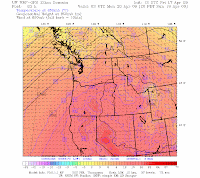 Hello to all and good morning. :o)
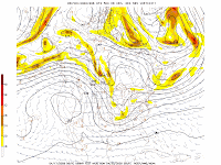
Models are very much in agreement about some ridging over the weekend after today showers with todays highs getting into the 50`s/60`s. Maybe even see some sun breaks by later this evening or if not sunshine, at least some breaks in the cloud cover.
But not to worry, there will certainly be sunny skies for the weekend as moderate ridge of high pressure will be nearly on top of us with 500mb heights getting into the low-mid 570`s with 850mb temps rising up to about +10c by late sun evening. Though aloft, there looks to be SW-WSWLY flow, so this will probably keep surface temps from getting to warm. None the less though, WRF12z for Sat is showing mid-upper 60`s to maybe 70 with Sun showing low-mid 70`s. And depending on what model you choose, it appears that high pressure may last into about Tue or maybe Wed, however it will be weakening by this time as the ridge begins to break down and an area of low pressure or trough drops down over our region from the NorthWest to provide us with cool and showery conditions as low level thicknesses drop back into the low or mid 520`s with 850mb temps between 0 and -4c or so.
With this some what cool trough in place, should see highs back in the 50`s as this trough looks to be with us for next weekend, but if you are to believe the Canadain GEM model, it shows another possible ridge for that weekend. But this is to far to say what will happen, so will keep checking the models to see what they show over the coming days ahead.
Have a good, sunny weekend you all. :o)
Wednesday, April 15, 2009
Update on the ridging for the weekend

 Taking a look at the models here, I see that on the 06zGFS and 00zGEM model from last night that they still want to swing a weakening frontal system through here for LATE tomorrow evening and into wee hours of Fri morning. And looks like thicknesses will be in the low-mid 540`s as the front comes through, but behind it, only a few showers may exist as high pressure starts to build in for the weekend. EURO/GEM/Canadian
  and ensemble charts don`t really start to pump up our ridge until Sun or Mon. But it does look pretty nice as by Sun afternoon 850mb temps are near or at +10c with 500mb heights in the 576dm range. So given what is shown, we should easily see highs low-mid 70`s with maybe even some upper 70`s as shown by last nights WRF12z. However, the MRF-MOS shows low-mid 60`s for the weekend, which may be too cool given that the ridge really begins to strengthen on Sun. So will continue to look at the models and see what they do with the ridge
Monday, April 13, 2009
Possible ridging...
looking at the 00zGFS tonight, I see that weak ridge is still showing to slide through here for the Wed/Thurs period with 500mb heights in the upper 550`s. But then come late Thurs afternoon and into Fri, it appears a weak system slides through our region for a few showers at times and also near zonal flow with heights near 570dm. So would say highs in the mid-upper 50`s to perhaps low 60`s for that day. And for Sat, looks like skies may be mostly cloudy with chance of showers as a weakening system just off shore brushes us, though heights still stay around the low 570`s. And like the 18zGFS, the 00zGFS begins to build the ridge up some by later Sun and into Monday for some further warming and drying.
Sunday, April 12, 2009
Showers likely with possible afternoon T-Storms tomorrow
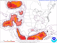

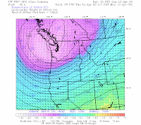 Good evening all.
In the very short term, it appears that tomorrow afternoon could be on the
 convective side of things as a cold -36, -37c 500mb trough moves over our region during the day tomorrow as seen on the 12zWRF at hour 36 or 5pm. Also if you`ll notice behind this well defined frontal system seen on the attached visible satellite imagery, that there is plenty of showery cumulus clouds behind the system. These cumulus/ cumulus congustus clouds will make their way over Western Wa tomorrow in the unstable air mass that is due to come over us. So with a cool/cold unstable air mass and 850mb temps of about -6c, we could very see some isolated and scattered T-Storm activity. But to get any t-storms, we`ll need to see some good sun breaks to get the heating and convetion going.
Another factor in the unstable air will be CAPE values, though those look margnial and in the 300-500j/kg range with lifted indexes of -1 to -3c(see AVN model) and LAPSE of -8 to -9c as shown by the SREF-Short Range Ensemble forecast-(see sref model image). So with unstable air mass in place, we could also see ice pellet showers and or smal hail. With that said, tomorrow afternoon could be bit of a interesting day as those showery type clouds move in over our region.
So feel free to comment on this! :o)
Friday, April 10, 2009
Weekend weather outlook...

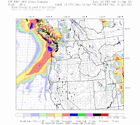 Checking out the models here tonight, the 12z/18GFS shows a weak system sliding through during the over night hours of tonight and into tomorrow. The 00z this this as well. This is currently shown on inferred satellite imagery. So tomorrow, expect another day with clouds and a few showers at times with highs in the 40`s/ 50`s. Now for Sunday, this is still looking to a fairly wet and cool day with highs probably around 50. So not the best of days for doing anything outdoors. So it`ll be rainy at times with gray skies to boot. Mon/Tue will be cool and showery at times with thicknesses in the low-mid 520`s and 850mb temps between -4 and -6c depending on what model you choose. So could be some snow showers in the mountains. In fact, WRF00z is showing the Cascades picking up several inches of snow from Mon morning through late Mon afternoon/evening with North Cascades picking around a foot a or more of snow. So over all, a cool and unsettled pattern can be expected over the next several days with possibly a return to warmer/drier weather starting about Wed or Thurs as ridging looks to take place into the extended period.
Note: Both images shown are for early Sun morning at 8am with first image showing the 850mb winds and second image showing our frontal system coming for Sun.
Tuesday, April 7, 2009
Cooler temps this week
 Looking at the models here, temps should still be mild through at least Sat, though not nearly as 'warm' with highs in the low to mid 50`s with just a few showers at times but it does`nt look like it`ll be all that wet of a week. And mainly the only weather system to come through this week, besides the weekend, is a weakening frontal system that looks to come through for during the day Thurs with a very weak but small trough following behind it. So not to bad for rest of the work week as Fri still looks mainly dry though could be a few sprinkles here/there. However once Sunday comes around, that looks to be a fairly wet and cool day with us possibly seeing highs in the 40`s as we get the cool NWLY flow aloft.
For Sun into first half of the work week, both GFS and EURO and also a few ensemble charts show a large trough moving over our region and over large part of the Western US for cool/showery and unsettled conditions with snow in the Cascades for Sunday. So an unsettled pattern looks to be with us for the weekend and into the start of perhaps the upcoming work week ahead.
Attach image is from the 18zGFS in which it shows a weak system coming through for Thurs morning.
Sunday, April 5, 2009
A look at the week ahead...

From what is seen on this morning 12WRF, is that things cool down just a bit for the Wed-Fri period with some rain and showers at times as a cooler airmass moves over region with SW-Westerly flow aloft. 925mb temps during this period look to be in the 0 to +4c with 850mb in the - to -6c range with the colder 850mb temps looking to near the weekend. Fri looks mainly dry, though likely cloudy, so perhaps an ok day for hiking again, but looks like the chance of a 'few' showers may be with us. Sat also features some showers at times, but Sun appears to feature a ridge. Should also note that WRF12z has going from upper 60`s to low-mid 70`s for Mon/Tue, down to the 40`s/50`s for highs for the Wed-Fri period. So bit of a noticeable temp change for mid-late week. 18zGFS NCEP model shows similar conditions and looks like the transition for the cool down will come on Wed morning when a cold front will slide through here with a deep trough slowly sliding through our region behind the front with some showers at times with Fri also looking to be mainly dry except for maybe a few mountain showers. GFS also still in line with some ridging on Sun.
However on the flip side, EURO model is still showing the continued idea of unsettled weather right through the weekend with GEM model keeping unsettled with rain/showers at times. But in looking at the 12z/18z ensemble charts, some of them seem to be more inline with recent GFS runs and in showing a weak ridge for late in the week. So given what is shown, the model confidence remains low at this time for later in the week due to model uncertainty.
However on the flip side, EURO model is still showing the continued idea of unsettled weather right through the weekend with GEM model keeping unsettled with rain/showers at times. But in looking at the 12z/18z ensemble charts, some of them seem to be more inline with recent GFS runs and in showing a weak ridge for late in the week. So given what is shown, the model confidence remains low at this time for later in the week due to model uncertainty.
Friday, April 3, 2009
The Weekend! :o)
The weekend is here folks! And it looks to be a sunny/warm one!
Looking over a few models here tonight, the weekend is looking to be very nice one as we`ll have a ridge in place over our region and also East-SELY flow here at the surface and at the lower levels(850/700mb). So we should see between 5 and 10 degrees of warming for tomorrow through Monday and maybe Tue, but Mon looks to the warmest day with possible highs in the lower 70`s per the 12z/00zWRF But tomorrow look to feature highs in the low to mid 60`s with mid to maybe upper 60`s on Sun. So will be a nice break from this recent rainy/cool weather as of late.
In the extended for the early part of next work week and depending on what model(s) you choose, our ridge could perhaps last into Wed if you are to believe the 12zEURO/ 18z ensemble charts and maybe even lasting into Thurs when you look at the 12z run of the Canadian model. On the other hand, GFS00z weakens the ridge by mid week with a weakening system/trough starting to slide through during this time and thus returning to cool and wet conditions. So we`ll have to see how the models play out over next several days.
But in the mean time, have a great and sunny weekend!
Weekend looking good....
Looking at the models here, high pressure will start building in later today and last t hrough the weekend with much warmer and also drier conditions. And temps should warm up pretty nicely as we get E-SELY winds here at the surface with thicknesses getting into the lower 550`s and upper level heights in the mid-upper 550`s by late Sun into Mon. 850mb temps rising as well and look to be right around +8c. Looks like we stay dry, mild, and mostly sunny through about Tue as per the 00zEURO and GEM model due to split flow aloft with area of low pressure dropping south along the far off-shore waters of the west coast. However, this mornings 12NAM shows high clouds moving in early tomorrow afternoon with mid level clouds coming in during the evening hours. So this may prevent temps from getting to high, we`ll see.
And then for Wed into rest of the work week, it appears we return to our cool and wet, unsettled weather as clouds and showers return by Wed Morning with small trough dragging through for the Thurs/Fri period. And lastly, the Sat/Sun period looks fairly wet and cool with near zonal flow aloft with thicknesses lowering back to the lower 540`s to mid-upper 530`s.
 hrough the weekend with much warmer and also drier conditions. And temps should warm up pretty nicely as we get E-SELY winds here at the surface with thicknesses getting into the lower 550`s and upper level heights in the mid-upper 550`s by late Sun into Mon. 850mb temps rising as well and look to be right around +8c. Looks like we stay dry, mild, and mostly sunny through about Tue as per the 00zEURO and GEM model due to split flow aloft with area of low pressure dropping south along the far off-shore waters of the west coast. However, this mornings 12NAM shows high clouds moving in early tomorrow afternoon with mid level clouds coming in during the evening hours. So this may prevent temps from getting to high, we`ll see.
And then for Wed into rest of the work week, it appears we return to our cool and wet, unsettled weather as clouds and showers return by Wed Morning with small trough dragging through for the Thurs/Fri period. And lastly, the Sat/Sun period looks fairly wet and cool with near zonal flow aloft with thicknesses lowering back to the lower 540`s to mid-upper 530`s.
Thursday, April 2, 2009
Nice, Mild weekend still looking good...
Looking at the models here, things are going pretty good as far as the weekend goes as we should have mostly sunny skies during this time frame with off shore flow as a large cut-off low drops south along west coast. It also appears that this mornings GFS runs has this low even farther off the off-shore waters of the west coast. So other than perhaps some passing highs clouds at times from that cut-off low, skies should be generally sunny and mild. Not only that, but Easterly to ESELY flow is showing up at the 850/925mb level, which in turn should 'heat' us up due to down sloping winds off the Cascades. Low level temps just above the surface look to rise nicely as by later Sun into Mon, 925mb temps are near +16c with 850mb temps near +8c on the 12zWRF though temps just a tad cooler on the operational 6z/12zGFS, but still a nice rise none the less. Now however what the 12zWRF shows(108hr) that the NCEP GFS model don`t, is what appears to be a weak 1008mb thermal-low that gets ejected out of the southward moving low. This thermal low looks to move up into NW Oregon by Monday afternoon with 925mb temps of +16c with East to SELY flow. Should be quite warm for the models are worth.
Now as far as temps goes, highs on Sat look to be near 60 or in the low 60`s with mid 60`s to possible few upper 60`s on Sun. Now here`s where it gets nice`n and warm, though the model could certainly be over doing it. You ready? Mon highs on the 12zWRF show possible lower 70`s with lows on Sun/Mon being in the low 50`s. So some nice and very spring-like weather still looks pretty good at this point. And for the extended period, the Mon-wed still looks mainly dry, mild and probably a bit above normal. GEM/Canadian/EURO also show weak ridging of sorts for first half of the work week. But again, models can over do things, so we`ll just how warm it gets over the weekend. On the other hand, think Seattle NWS is forecasting lower 60`s, while 12zMRF-MOS is too cool in my opinion as it shows 50 on Sat/ 59 Sun/ 62 Mon. So I think the MOS may be playing it on the cool side and not really factoring in what is being shown in the models as the low levels do dry up and warm up some on Sat with further drying/warming on Sun. But over all, it`ll be a nice break from this cool and rainly weather we`ve been having lately.
Now as far as temps goes, highs on Sat look to be near 60 or in the low 60`s with mid 60`s to possible few upper 60`s on Sun. Now here`s where it gets nice`n and warm, though the model could certainly be over doing it. You ready? Mon highs on the 12zWRF show possible lower 70`s with lows on Sun/Mon being in the low 50`s. So some nice and very spring-like weather still looks pretty good at this point. And for the extended period, the Mon-wed still looks mainly dry, mild and probably a bit above normal. GEM/Canadian/EURO also show weak ridging of sorts for first half of the work week. But again, models can over do things, so we`ll just how warm it gets over the weekend. On the other hand, think Seattle NWS is forecasting lower 60`s, while 12zMRF-MOS is too cool in my opinion as it shows 50 on Sat/ 59 Sun/ 62 Mon. So I think the MOS may be playing it on the cool side and not really factoring in what is being shown in the models as the low levels do dry up and warm up some on Sat with further drying/warming on Sun. But over all, it`ll be a nice break from this cool and rainly weather we`ve been having lately.
Wednesday, April 1, 2009
Very nice weekend looking good so far..(Thoughts anyone?)
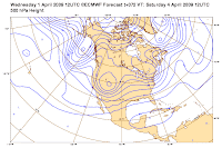
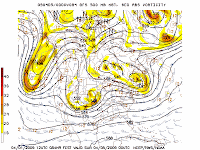 From what is shown in the latest series of models from this morning, is that a very nice and mostly sunny weekend looks to be in store for us. And also should be rather mild with highs in the 60`s with perhaps Sun or Mon following week being the warmest of the two days. Our ridge looks to start moving in by around later Fri into Sat with drying and warming taking place as both GFS 6z/12z models are showing E-SELY flow at the surface while having SELY flow at 850-700mb. 10m temps look to have a nice jump and rise up to +10c with 850mb temps right around +4c on Sat and then up near +6c for Sun/Mon. But as just mentioned, think Sun/Mon could be ''warm'' and likely above avg by April standards(avg. high for me is 59) as we get near or right at easterly flow at the surface and at the 850/700/500mb level for that Sun/Mon period. And this flow aloft will be due to an area of large low pressure that eventually gets cut-off from the northern jet with the low sinking south along the west coast or moving into OR/California by early next week.
That being said, other such models like the GFS/GEM/Canadian/MRF, they are coming around to more recent runs of the EURO model....including todays 12z EURO that has been and is still showing split-flow taking place for first half of next week. Assuming this comes to fruition, this means that the weather for us here in WA/OR will be calm with not much going on as we`ll be mainly dry and in no-mans land with systems shearing/splitting apart as they enter the upper level splitting jet. So going out on a limb here, would say mild conditions with temps a little above average for first half of next week. Even 12zWRF is showing highs near 70 for Sun and chance of a few places seeing lower 70`s Monday. But that is getting to far in the lon range to even forecast any such temps. So we`ll see how it goes.
Subscribe to:
Posts (Atom)
